NAVBasics has been designed for the junior officer undertaking study. The three volumes have been divided carefully, bringing together items that are usually taught in tandem and ensuring the order flows in a logical manner.
It is written in plain English and contains numerous diagrams, worked examples and exercises on key areas of the Navigational Syllabus. Information that is formally part of the syllabus is held in sections at the end of each volume, providing a useful start to the additional reading recommended for all junior officers.
NAVBasics was written by a Senior Navigational Lecturer and was updated in 2011.
£90.00

NavBasics
Volume 1
1 The Earth
1.1 Shape of the Earth
1.2 Position and Directions on Earth
1.3 Magnetic Compass and Compass Error
1.4 Gyro Compass
1.5 The Navigational Chart and Projections
1.6 Chart Production
1.7 Interpretation of Information on Charts
2 Coastal Navigation
2.1 The Basics
2.2 Tools for Chartwork
2.3 Plotting Bearings and Courses on Chart
2.4 Plotting Distances on the Chart
2.5 Plotting Latitude and Longitude on a Chart
2.6 True and Compass Course Conversion
2.7 Fixing Position
2.8 Leeway
2.9 Checking position by Soundings
2.10 Running Fix
2.11 Doubling the angle on the bow
2.12 Vertical Sextant Angle
2.13 Horizontal Angles
2.14 Offshore Danger Angles
2.15 Clearing Bearings
2.16 Chart Work Errors in Plotting
3 Tides
3.1 Formation of Tides
3.2 Meteorological Effects on Tides
3.3 Under Keel Clearance
3.4 Overhead Clearance
3.5 Tide Calculations
3.6 The Pacific Tides
3.7 Tidal Streams
3.8 Tidal Stream Data given in ATT
3.9 Use of Computer Programs to Obtain Tidal Information
4 Passage Planning
4.1 Planning – Principles
4.2 Planning Stages
4.3 Procedure for Chart Selection
4.4 Passage Planning Example
4.5 Passage Planning Checklist
4.6 Chartwork Legends
4.7 Reasons for Notice to Engine Room
4.8 Wheel-Over Point Calculation
4.9 Passage Planning with ECDIS
4.10 Additional Considerations for Passage Planning with ECDIS
4.11 Use of Admiralty Routeing Guides for Passage Planning
4.12 Use of Admiralty Routeing Charts for Passage Planning
5 Nautical Publications
5.1 Introduction
5.2 The Nautical Almanac
5.3 Admiralty List of Lights and Fog Signals (ALL) – Paper Based
5.4 Catalogue of Admiralty Charts and Publications (NP 131)
5.5 Admiralty Tide Tables and Tidal Stream Atlases
5.6 Admiralty List of Radio Signals (ALRS)
5.7 Publications for Fishermen
5.8 Admiralty Sailing Directions (Pilot Books)
5.9 Nautical Tables
5.10 Mariner’s Handbook (NP 100)
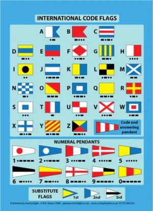
5.11 International Code of Signals
5.12 Standard Marine Communication Phrases (SMCP)
5.13 Weekly Edition of Admiralty Notices to Mariners (ANM)
5.14 Annual Summary of Admiralty Notices to Mariners (NP 247)
5.15 Cumulative List of Admiralty Notices to Mariners (NP 234A and NP 234B)
5.16 Chart Correction Log and Folio Index (NP 133A)
5.17 M-Notices
5.18 Ocean Passages for the World (NP 136)
5.19 Miscellaneous Publications
Volume 2
1 Ocean & Offshore Navigation
1.1 Trigonometry
1.2 Using Napier’s Rules
1.3 Rhumb Line Navigation
1.4 Great Circle (GC) Sailing
1.5 Proofs
2 Celestial Navigation
2.1 Sextant
2.2 Celestial Coordinate System
2.3 The Horizon Coordinate System
2.4 Time and Time Measurement at Sea
2.5 The Compass Error
2.6 Sextant Altitude
2.7 Meridian Passage
2.8 Celestial Position Lines
2.9 Latitude by Meridian Altitude
2.10 Polaris
2.11 Marcq St Hilair or Intercept Method
2.12 Longitude by Chronometer Method
2.13 Position by Multiple Simultaneous Observations
2.14 Planning Sights
Appendix 2. Additional Reference Material
Volume 3
1 Navigation and Watchkeeping
1.1 Phases of Navigation
1.2 Methods of Navigation
1.3 Navigation in Ice
1.4 Watchkeeping Procedures
1.5 Watchkeeping at Anchor
1.6 Watchkeeping with Pilot
1.7 Circumstances in which the OOW Should Call the Master
1.8 Watchkeeping in Emergencies
1.9 Shipboard Communications and Alarm Systems
1.10 Record Keeping and Logbooks
1.11 Introduction to IALA Maritime Buoyage System
2 Electronic Navigation
2.1 Electronic Charts
2.2 Global Navigation Satellite Systems (GNSS)
2.3 NAVTEX
2.4 Hyperbolic Navigation Systems
2.5 Automatic Identification System (AIS)
2.6 Voyage Data Records (VDR)
2.7 Ship Security Alert Systems (SSAS)
2.8 Integrated Bridge and Navigation Systems
2.9 Echo Sounder
2.10 Speed Logs
3 Radar Navigation
3.1 Radio Wave Basics
3.2 The Radar System
3.3 Controls and Initialisation of a Marine radar
3.4 Checking Heading Marker Alignment
3.5 Use of Radar for Making a Landfall and Radar Horizon
3.6 Weather Factors Affecting Radar Abilities
3.7 Other Factors Affecting Radar Abilities
3.8 Use of Radar for Navigation
3.9 Radar Presentation and Display Modes
3.10 Radar and Electronic Charts
3.11 Radar and AIS
3.12 Radar and SART
3.13 Radar Plotting
3.14 Use of Radar for Collision Avoidance
3.15 Automatic Plotting Aids
3.16 Automatic Radar Plotting Aid (ARPA)
© 2022 - Search4local Ltd. The content of this website is owned by us and our client; copying of any content (including images) without our consent is in breach of our Terms & Conditions. | All rights Reserved